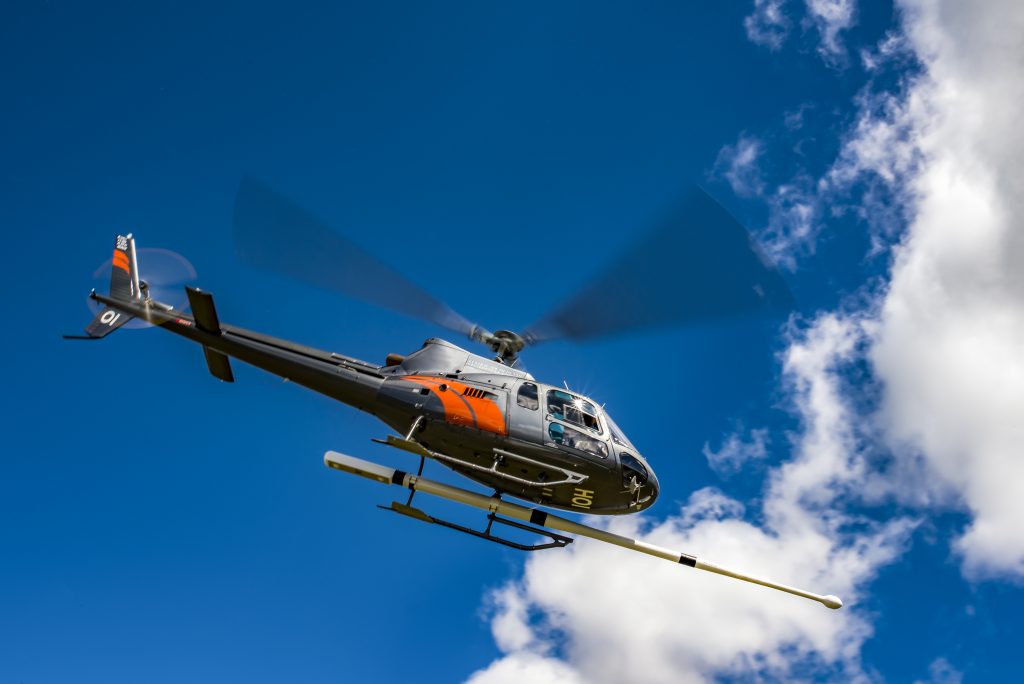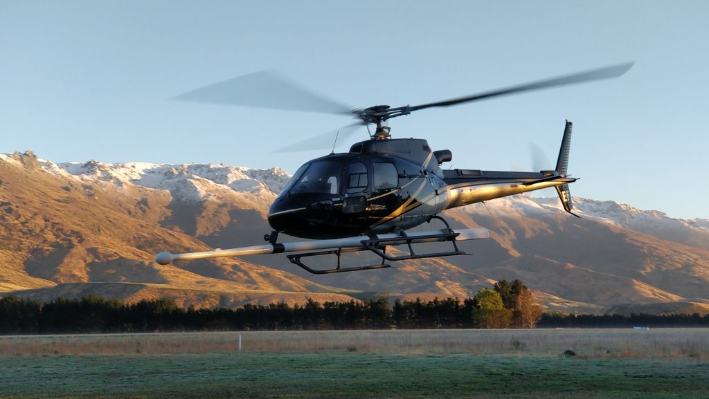
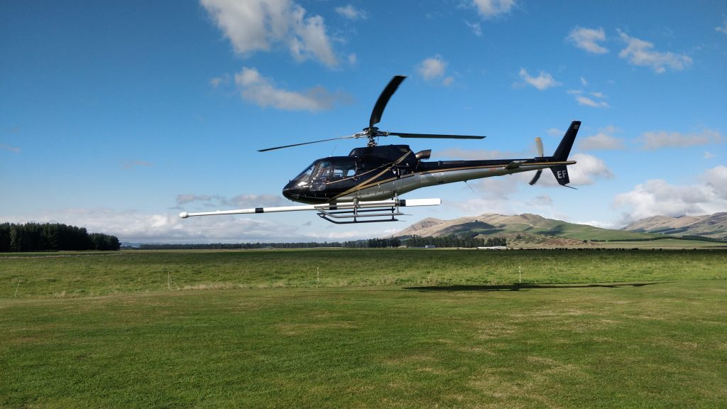
To the uninitiated, low-flying helicopters with protruding booms that look like jousting lances flying back and forth over the same patch of terrain would seem an odd activity.
For Australia’s Griffith-based Thomson Aviation Geophysical Survey it’s all in a day’s work. It has been doing this repetitive process over several summers in New Zealand and for 25 years in Australia’s vast hinterland and in other countries.
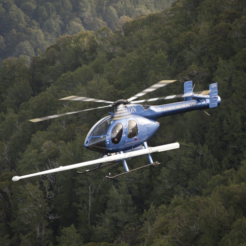
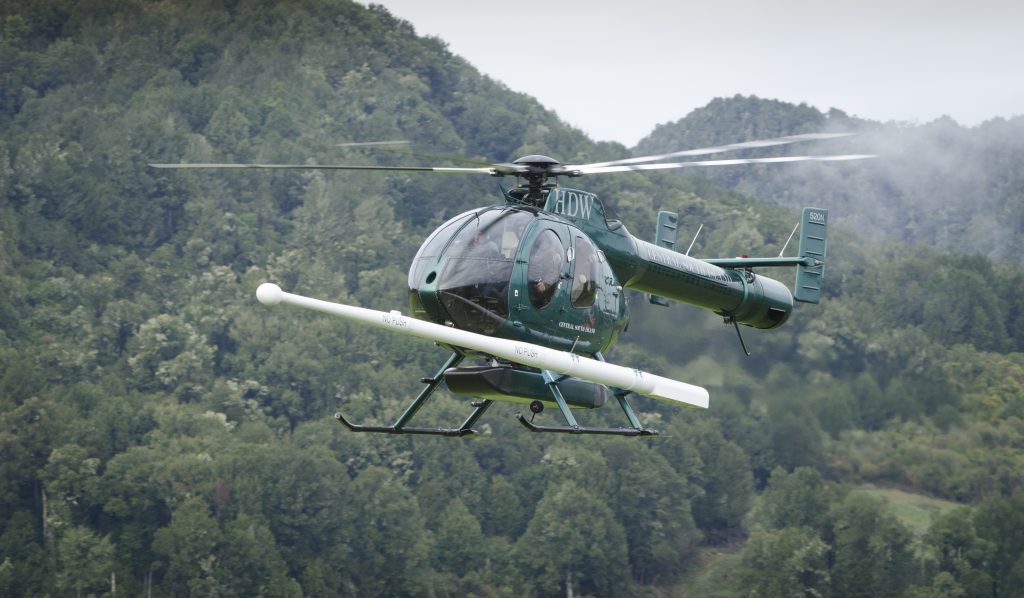
The aeromagnetic surveying specialist’s back and forth action is to make a grid pattern over a particular area, using helicopters or fixed-wing aircraft. The sensor in a magnetometer on the boom, and another data box in the aircraft, gathers high-quality geological data about mineral deposits and other materials hidden in the terrain below by measuring natural variations in the earth’s magnetic field and naturally occurring levels in rocks. The information can identify areas with mineral potential.
Thomson’s New Zealand commission for this work came from a successful tender for a NZ$6 million (A$5.65m) contract issued by the government’s petroleum and minerals arm as part of an $8 million investment to gather new data over a six-year timeframe.
The New Zealand government allocated funding for the project in its 2014 budget because much of the country lacked high quality data about its geology and its potential prospectivity, even though it had a long history of mining.
The New Zealand Petroleum and Minerals (NZPM) arm wanted the data from the aeromagnetic surveys to help it better understand the potential mineral endowment in the regions and to get an insight into geological hazards, regional water sources, climate, soil and geology.
Given the country’s sensitivity about mining, NZPM has said that if geologically prospective areas were identified, it was not a given that the area would be explored or mined because any resource development would need the right authorisation under the Resource Management Act. The New Zealand government has also made a commitment that no mining would be allowed on world heritage areas.
But the Ministry of Business, Innovation and Employment has expressed interest in potential mineral deposits that could be used in renewable technology such as lithium, nickel-cobalt and rare earths.
Data detail
In technical terms an aeromagnetic survey offers the highest resolution airborne magnetic, radiometric, gravity and digital terrain data possible.
Thomson’s airborne geophysics operator Michael Brayne says the survey not only identifies mineral deposits but also provides information about earthquake faults, groundwater aquifers and soil.
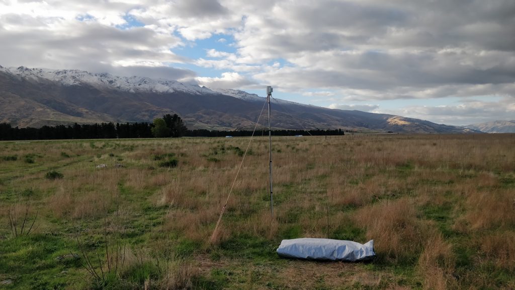
To read the data it uses a RS-500 airborne gamma ray spectrometer from Canadian company, Radiation Solutions.
It is described in specifications as the most advanced airborne gamma-ray spectrometer system, utilising leading edge technology for previously unachievable levels of spectral data performance.
Radiometric and magnetic data is processed by Thomson Aviation at its in-house data processing centre, using specialised software for data quality control and final processing.
Weather dependent
As 2019’s summer folded into autumn, snow had already dusted the tops of the mountains behind Mossburn Airfield in the northern Southland region of New Zealand. After a few days there, and around the Remarkables mountain range in the Queenstown area, the airfield is where surveying will stop for winter.
This early May morning the helicopter has been on the ground for several hours because of low cloud.
Winter’s unpredictable weather is not conducive to data mining, particularly in snowy conditions. Brayne says the sensors are passive and read naturally what is coming from the surface so they can’t read through water or snow.
He said the same applies to oil and gas. Hard crusts were typically found above large oil and gas deposits that were under very high pressure deep in the earth so they couldn’t be read well by aeromagnetic means.
“It’s more about the ability to get a strong detection of what is there,” he says.
Electromagnetic loops that look like circular clotheslines are better suited for oil and gas surveying.”
Covering the areas in the New Zealand project clocks an average of 2,000 line kilometres a week.
“There is no deadline because the contract is paid on a line kilometre rate so bad weather is obviously not good for us,” Brayne says.
“It takes a long time because we shut down for eight months of the year.
“There are indications we are a bit behind schedule because of the weather but we expect to have the work completed by the end of this year although it could take longer if the weather is not on our side.”
He said it also depended on what aircraft was used. “With a helicopter we can cover 600km a day and with fixed-wing aircraft, 1,200km. Terrain is the determining factor of what we use.”
Brayne, like others in this field, has a technical background in computer electronics and electronic systems.
He‘s on secondment from Thomson’s Griffith head office – also his hometown. His job is mainly on the ground, ensuring equipment worked and was in the right place while Thomson did data-to-data checks daily from Australia to make sure the surveying sensors were working.
The fleet
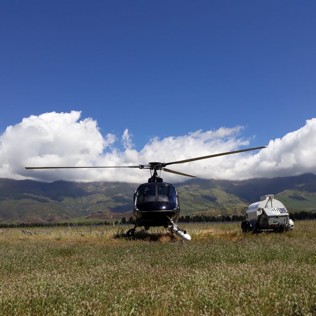
The New Zealand project uses fixed-wing aircraft and helicopters.
Pacific Aerospace, a New Zealand aircraft builder in Hamilton, built Thomson’s single-engine P-750XL plane.
Thomson also has four Cessna 210 Centurions and twin-engine Squirrel and MD500 helicopters on call for the New Zealand project.
“We bought our AS350 Squirrel helicopter in Australia but it now lives in New Zealand where it did its first survey,” Brayne says.
Thomson transports the helicopters in shipping containers to New Zealand and elsewhere and re-assembles them at the other end.
“We can’t do surveys in a lot of areas with aircraft because they can’t climb fast enough or get as close as the required 35m range without disturbing tree canopies,” Brayne says.
Helicopters must be able to climb up sheer cliff faces of 600m or more at the rate of 600m a minute while only 35m from the rock face.
There are three types of Squirrel helicopters that can climb heights at that rate, the AS350 B3 being the most powerful. One once landed on Mt Everest in a test flight.
The McDonnell Douglas MD500 had proved useful for New Zealand’s rugged West Coast, Brayne says.
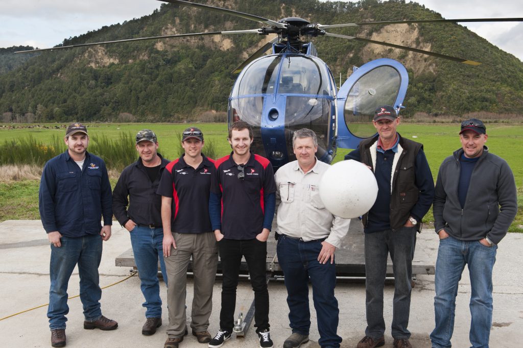
Herbert-based Central South Island Helicopters, near Oamaru in North Otago, maintains the aircraft and helicopters and contracts them out during the off-season for other types of survey work or for firefighting. Brayne says New Zealand is a good place to work because getting access to airframes and pilots who could fly them was not difficult.
Anomaly search
Terrain being surveyed changes over an area but not rapidly so geologists analysing the data look for magnetic abnormalities that identify different minerals.
“Raw magnetic or radiometric data is basically ultra-violet (UV) radiation. Every rock and mineral emits a natural signature,” Brayne says.
“The grid the helicopter flies shows the high points of the UV and the main one is the magnetic field.
As it is a big project spanning several years, data is sent progressively from the Australian head office to NZPM after analysis.
Brayne says that with smaller jobs of a month or less, data sent to head office each day for checking was retained until the final maps and grids were completed, and then sent to the client.
Thomson’s work this time round is focused in the South Island but it has also done work previously in the North Island.
In 2011 it did aeromagnetic surveys of terrain in the south–west of the South Island near Haast.
It was a defined area but was extended twice because the Southland District and Invercargill City and Gore District councils wanted to look at aquifers.
While the latest surveying is not completely focused on mining, typically an airborne survey is one of the first steps for a mining company, Brayne says.
After getting the data the companies prepare a budget for the drill program.
The New Zealand aeromagnetic survey has found fault lines that help experts determine earthquake patterns. It has also identified aquifers that benefit communities – hence why the local councils partnered with NZPM in their regions.
When working on an earlier project on New Zealand’s West Coast the Thomson team was diverted to Christchurch to survey the city after two catastrophic earthquakes in September 2010 and in February 2011. The latter killed 185 people.
Brayne says from what he has seen online since then, and reading between the lines, he thinks a lot of people were surprised the fault line came right into the city.
“New Zealand is on the ring of fire so it is a very interesting country to do surveys where magnetic data shows fault lines and underlying geology.”
Specialists
Thomson is one of a handful of companies in Australia that do aeromagnetic surveying. The work has taken it to Laos, Canada, South-East Asia, Papua New Guinea, Indonesia and New Zealand. It has also completed surveys in all Australian states for large and small exploration companies and for the Federal Government.
“It’s a good specialist market to be in but unfortunately, there is a little bit of saturation in this field in Australia and Canada,” Brayne says. Hence, the reason the company looks further afield to places like New Zealand.
Long-range
An aeromagnetic survey in Australia can mean a seven-hour flight, making only two lines in a grid – 3.5 hours one direction and 3.5 hours back – before fuel is an issue.
In Queensland, Thomson have three fixed-wing aircraft and six pilots on rotation for a project, enabling 12 lines in the grid to be made each day.
“They can’t actually get a lot more done than that as helicopters can’t travel at 100 or 115kph,” Brayne says.
As to drones doing this work in future, Brayne says one of the main limiting factors for drone-based technology in this field was that the sensors in an auto pilot system cannot follow terrain without getting too low or two high whereas a human could simply look out the window.
The other factor is weight. The magnetic sensor at the tip of that boom weigh two kilograms and the crystal pack radiometric sensors in the helicopter or plane weigh about 80kg each. Four crystal packs were used on the Pac750. All up the equipment weighed around 200kg – too heavy for drones.